Εικόνες δορυφορικές (interferogram) από τον Sentinel1, ανέβασε ο Σωτήρης Βαλκανιώτης Dr. Geologist στο tweeter…
Οι εικόνες αφορούν στην περιοχή της Λάρισας που έχει πληγεί από τον σεισμό 6.3 R της 3 Μαρ. 2021
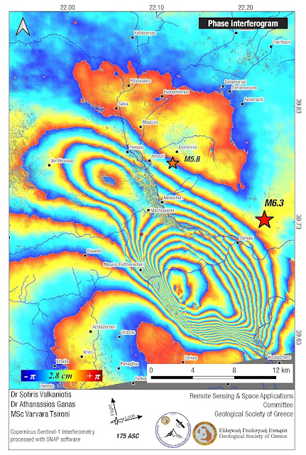
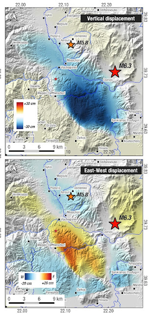
#Sentinel1 interferogram that includes deformation for both M6.3 & M5.9 #earthquakes in Thessaly, Greece, and ground displacement from combining ascending & descending unwrapped interferograms. Two NW-SE oriented blind normal ruptures. pic.twitter.com/RymRjTpGhL
— Sotiris Valkaniotis (@SotisValkan) March 9, 2021
Οι εικόνες (Ιντερφερόγραμμα) απεικονίζουν την παραμόρφωση για τους σεισμούς 6.3 & 5.9 R στη Θεσσαλία, όσο και την μετατόπιση του εδάφους (Οριζόντια & κατακόρυφα)….
Κάντε κλικ στις εικόνες για μεγέθυνση


